Spatial modelling of atmospheric water vapour with tomographic reconstruction using GNSS observations
DOI:
https://doi.org/10.30921/GK.76.2024.5-6.1Abstract
Permanent GNSS stations have been used for high-precision positioning tasks in surveying practice for several decades. It is known that the basic measurement result of GNSS observations, the satellite-receiver distance, is burdened with many regular errors. Besides track and clock errors, signal propagation errors like the ionosphere and troposphere also affect the measurements of permanent stations. However, by knowing the coordinates of the stations, we can determine the tropospheric effects affecting the satellite-receiver distances.
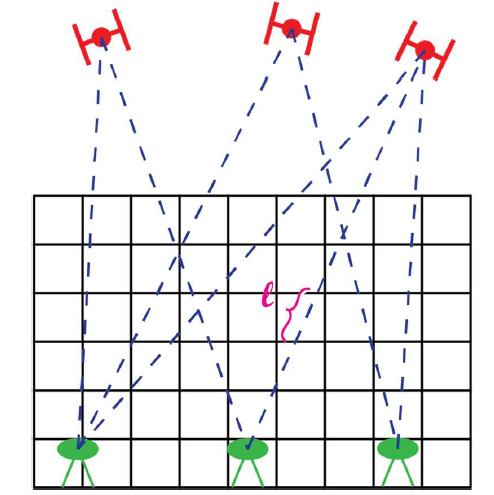
Tropospheric effects have a significant influence on the accuracy of satellite-receiver distances, especially those related to atmospheric water vapor. We can use this diversity to infer the spatial distribution of atmospheric water vapor because the satellite-receiver vectors travel through the atmosphere in various paths and directions. The utilization of a computerized tomography approach facilitates this inference.
This paper introduces a GNSS processing system that is used to determine the spatial distribution of atmospheric water vapor density in the Carpathian Basin every hour. The results are compared to observations from several radiosonde stations. The data analysis demonstrates that the GNSS data, not only provides information about the vertically integrated water vapor content but also about its spatial distribution. This capability presents new opportunities for the meteorological use of GNSS observations.

